Satellite data reveals unexpected global rebound of mangrove forests since 2010
New satellite research shows global mangrove forests are expanding after decades of decline, growing by nearly 2,000 square kilometers since 2010.
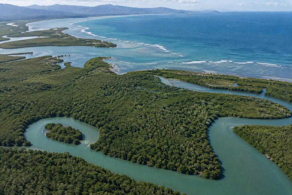
Satellite imagery collected between 1984 and 2023 reveals a surprising shift in the world’s mangrove forests. For decades, researchers using equipment from the Landsat satellite program recorded widespread loss and degradation of these coastal trees. However, recent scientific analysis published in the journal Science indicates that a global rebound began around 2010. Researchers documented a loss of nearly 3,000 square kilometers between 1984 and 2010, followed by an unexpected increase of nearly 2,000 square kilometers.
Drivers of Mangrove Recovery
Experts point to several factors behind the turnaround, including heightened conservation awareness following the 2004 Indian Ocean tsunami and stricter legal protections. About one-third of the recent growth stems from active restoration and the regrowth of degraded areas. The remaining two-thirds happen naturally as mangroves colonize new mudflats created by heavy sedimentation, particularly in regions like South America and Australia. In places like Burma, trees have even begun to grow back in abandoned rice fields.
Regional Challenges Remain
Despite positive global trends, recovery is not universal. West and Central Africa have experienced net losses since 2010, particularly in the Niger Delta. Parts of North America and southern Africa have also suffered damage from severe tropical cyclones. Scientists emphasize that while the recent expansion offers hope for carbon storage and coastal protection, ongoing deforestation and storm risks mean conservation efforts must continue.
How does this story land?
One tap per reader.
Quick poll
Surprised mangroves are growing?
One vote per reader. Results show after you vote.
Ask this story
Answers are written by AI from this story only. They can be wrong.